Ninth Blog from on board Perie Banou II
by Jon Sanders on 18 Jan 2017
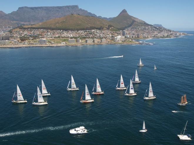
The Clipper Fleet under Table Mountain at the start of race 4 of the Clipper Race 09-10 from Cape Town, South Africa to Geraldton, Western Australia Clipper Ventures
Jon's unique tales from his epic 10th circumnavigation continues. Alas it was not the sea that got him, but a fall on the quay saw him endure some fractured ribs. Jon’s OK, and recuperating well, but his progress is slowed and he’ll be in Cape Town until February 13 to complete his recovery.
Jon’s 9th Blog
Perie Banou and I are tied up on jetty (or dock) H at the Royal Cape Yacht Club Table Bay Cape Town. Those who have sailed in and out of Table Bay would be amazed at the strength of the South East wind in summer. Strength of the SE wind reaches gale frequently.
Table Bay has the cold South Atlantic Current. Believe me it is cold. (Like San Francisco Bay) - that is in America). Interesting San Francisco Bay has the Prison Island of Alcatraz and Table Bay Robben Island - of Nelson Mandela fame. (Spent most of his 25 years gaol there). Bad idea for prisoners to attempt to swim from either Island. Bloody cold water and currents.
Not far away, to the south of Table Bay, is False Bay. A big bay. As the crow flies, it’s 15 miles distant. (Not that far). False Bay is washed by a warm current. Very warm - from the east coast of Africa.
A combination of cold current, warm current, mountains in the region, plus isobars squeezed near each other (even with high pressure recorded on the barometer) creates seriously strong wind. From the SE. The wind is sneaky; where it cannot go thru a mountain it goes around. Intensifying the howl.
One of the most wonderful maritime sights is the opening up of the iconic Table Mountain as it draws into view. 'Cape Town'. When the cloud forms on top of the mountain (the table cloth). It flows over the edge of the mountain, like a waterfall. The cloud dissipates about 20 percent down the massive cliff. One then knows the South Easter is going to be a honker. Will blow for a while.
I arrived in that wind. Not the first time. December 1975 was first time. (Heck what's going on?). - the South Easter had formed. Perie Banou II is now tied to jetty H the Royal Cape Yacht Club. For those who voyage via Southern Africa, RCYC is known as the Tavern of the Seas.
The Royal Cape hospitality is 10 out of 10 plus 1. The club office clears you into the club marina and organise immigration to meet you on board. In my case (with another younger single hander) we were asked to visit the Customs/Immigration office a couple of kilometres down the road.(All in the dock area). Here Customs and Immigration formalities were done quickly. Smiles all around. Nice. Plus no cost involved.
To get on and off floating jetty H is a ramp. At low tide it is steep. I tend to run up and down these things. Oops going down I tripped. Splat. I scrapped a bit of skin and cracked a few ribs. Sore. Very sore. Very very sore.
Next night was December 31 New Year's Eve. Celebrations at the clubhouse - end of jetty. Didn't attend. Too sore and sorry for myself. Felt yuck. Nothing improved. So days later I reluctantly saw a doctor recommended by the yacht club. I took samples of my idea of painkillers. The doctor smiled and told me they were useless. He wrote out a prescription for 'real ones'. Plus anti-inflammatory. He noticed the scrape on my leg, bit red and right foot swollen. (Thus penicillin went on the prescription list). The effect that night was immediate. I could sleep. Two days later I began to feel like a new man.
New man or no new man I am never going to run up or down that ramp or any other. Ever again. A week later workmen were replacing planks in that very ramp.
The Doctor was good. He went over everything. My breathing was good. My heart rhythm good. Blood pressure 130/70 rather good. Made me feel 'unkillable' (and charged me accordingly) I was happy.
I carry paper charts for the whole circumnavigation. From these charts I enjoy plotting waypoints for each leg. Most of my charts bought 1974. Most of the rocks are still around, now as then. Are most of the rocks and coast in the same location? As the B&G screen. - Navionics. Nup. Especially in the Galapagos and French Polynesia region. So I check and re-check.
I list my course and waypoints in my logbook. I have lots of logbooks. All this usually done at sea. But now un-mortally wounded with pranged ribs I have done it on the chart table whilst PB is tied up in dock. I.E. Waypoints from Cape Town to the Island of a Saint Helena. (British). To the British Virgin Islands (surprisingly British). To Panama.
I typed them all into my beautiful B&G machine. Even a Sidchrome spanner like me can navigate the B&G. Most important headings are not in type, but bold colourful pictures. And when you need to type numbers and letters, it is clear, bold with stacks of room to read very readable and add more letters or numbers. Anyway all waypoints are in the B&G. Cape Town to Panama Canal.
My first course is Cape Town to St Helena. One can expect fresh good following trade wind. And a neat sea. Is neat a good description? When sailing west of Cocos Islands in the Indian Ocean the trade winds are fresh to strong. The sea then is un-neat. (Well it is).
There are plenty of African workers, dockhands, etc Royal Cape. Nice. All nice. Here I see a similarity between indigenous Australians (Aborigines) and Africans. For the most they do not own or show interest in owning sailing yachts. Or go sailing for the love of it. They could. It seems un-aboriginal. They are brilliant at football, boxing, running but not sailing, like I do. It is something strange we do.
Regards to all.
Jon
.
If you want to link to this article then please use this URL: www.sailworldcruising.com/151167