Cruising in Southern California's Channel Islands
by Barb Peck and Bjarne Hansen on 26 Jul 2016
Cruising in Southern California's Channel Islands Bluewater Cruising Association
With 30 kts of wind behind and waves chasing us, we headed southeast. Occasional sideswipes by swell from other directions prompted us to keep a hand ready to spin the wheel to assist Hellena (our self-steering) in returning to course.
Hoku Pa’a had rounded Point Conception that morning at about 11miles off, and was blasting through the beautiful blue water of the Santa Barbara Channel. Spirits were high after three nights at sea, from reaching another milestone, the exciting sailing, and the prospect of being parked before nightfall. Channel Islands, here we come!
By 1615h, we had crossed the shipping lane, dodged a few freighters that popped up between the swells, and altered course for the anchorage. Our haven beckoned. Sunshine and warm Southern California waters lured us into peeling off our foulies. What a pleasure to air ourselves out in the sun and wind after three days of bundling up in banana suits! As we headed up, our apparent wind speed increased by about 12 kts. This shouldn’t be surprising, but somehow we didn’t really anticipate it.
Our heel increased and within minutes a large transparent blue wave broke into the cockpit, giving Bjarne and his clean dry sweatshirt an unwanted saltwater bath. That didn’t seem a very friendly welcome, but we carried on with only slightly dampened spirits. By 1645h, we were anchored in Bechers Bay, off Santa Rosa Island – just in time for happy hour.
A month and half earlier, (Sept second) we had departed Victoria, having moved onto Hoku Pa’a the evening before. Our first stop was an easy two and half hours away in Becher Bay (yep, almost the same name). Although we left one day later than tentatively planned, we deemed this pretty impressive.
Eleven years ago, we had moved onto Freya on the morning of departure, three weeks later than intended, and proceeded to bash our way out the Strait of Juan de Fuca, with the next stop Hawai’i. Back then, we had begun a 26 day passage already exhausted. This time, in our wise old age (?), we opted for a more leisurely start.
Although many folks check into the States in the San Juans or Port Angeles, then wait in Neah Bay for a good time to go south, we chose to hang out in the Deer Island group near Bamfield. Here we re-grouped, enjoyed the scenery, relaxed, did a few more of those tasks that didn’t get done before leaving the dock, and waited for good weather.
We avoided one port stop, postponed check in paperwork, and didn’t yet need to start buying things in the US with our devalued Canadian dollar. The day before departure, we topped up our provisions in friendly Bamfield and headed offshore.
Getting to San Francisco
Strong north winds gave us a fast downwind sail, allowing us to glide under San Francisco’s Golden Gate in only six days, 20 minutes. We spent an enjoyable month in this attractive (and expensive) city, sight-seeing, dealing with repairs, and re-acquainting ourselves with the cruising life. Timing one’s departure from San Francisco has the additional constraint of dealing with the bar conditions (unfortunately I don’t mean the types that serve rum). Although it may be that those with local knowledge will brave a greater range of conditions, warnings in the guidebooks had us feeling cautious.
We decided the best approach was to depart when the bar conditions were good, but only go the 20 or so miles to Half Moon Bay – so it wouldn’t matter as much the time of day when we left. When thick fog encased us about two miles out, at least we didn’t have very far to thread through it. We enjoyed peaceful Half Moon Bay (except for the plethora of flies). From there, we by-passed the next towns on the Coast and made straight for the Channel Islands.
There isn’t a right or wrong about harbour-hopping vs. the just-go-for-it approach; nor about urban vs. wilderness, except to consider what you yourself is interested in and what you can tolerate. Some of the things we like about sailing are connecting to nature and wildlife, and experiencing the self-reliance that comes from visiting more remote areas. Having just spent a month in the big city of San Francisco, the idea of hanging around more towns was unappealing.
Admittedly, once we’ve had sufficient time away, we are happy to return to urban life to reconnect with people and restock rum and other important supplies. It’s not our intent to advocate where or how to go; nor to provide a comprehensive travel guide, but since we don’t recall having read much in Currents about the Channel Islands we thought we’d share some of our experiences.
We had the pleasure of visiting four of the eight Channel Islands. Although each island has its own history, flora and fauna, they all share a hilly ruggedness and a dry climate. Access is restricted in some islands and areas, either as part of conservation efforts, military presence or private ownership. To get a permit, one needs to plan well ahead – we didn’t visit any locations where one was required. There are few if any places that would be considered all-weather anchorages.
When deciding where to go, it is necessary to factor in both wind direction and strength, as well as swell height and direction. One needs to be prepared to deal with sudden weather changes as well. For most of our time in the Channels there was significant swell and wind from multiple directions, so almost every anchorage was exposed to something. The swell also influenced our ability to go ashore. Nonetheless, we enjoyed our time here, especially in the less developed islands.
Santa Rosa Island
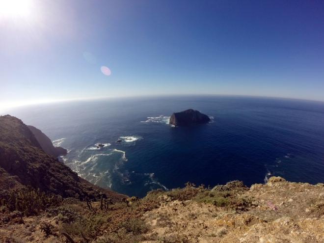
Santa Rosa is the second island from the west. The large anchorage is protected on two sides by steep, reddish hills and cliffs – the rest is open to the sea. There were no other boats, but a long pier remains from when there was an extensive cattle ranch here. A lone horse was spotted grazing in the distance. We anchored about 300m offshore, behind the steep cliffs that protected us from waves. However, the strong winds blasted right over top and kept our rigging singing for most of the night. We did not go ashore, deeming the conditions to be too windy and swelly.
Although Santa Rosa provided welcome respite following our rounding Point Conception, in these conditions it was not really peaceful, so we moved on downwind the next day.
Santa Cruz Island
We visited two of the several anchorages on this Island. One could easily spend many more days exploring the various places, all depending on the weather of course.
After a couple of hours sailing from Santa Rosa, we tucked into Albert’s Anchorage, on the south side of Santa Cruz Island. The high cliff just 50m west of our boat, dominated the scenery. It appeared fairly uniform, dark and resulted in an early sunset. However, the morning sun on the wall revealed a greater array of colour and texture – surprisingly beautiful. In front of the small beach at the head of the cove was a reef that followed the shore and paralleled the cliff. Without a permit, one isn’t allowed to go ashore here, but there is no restriction on being in the water.
Despite the disappearance of the sun just after our arrival, it didn’t take long for Bjarne to don his mask and snorkel. I chose to wait for the morning light and warmer air temperature. The snorkeling highlight of this cove, in addition to the fact that the water was getting warmer, was the kelp. Great tall strands reached up to the surface, while rays of sun streamed into the water, lighting up the graceful swaying green leaves. A keen eye could spot some well-disguised fish hiding in the kelp leaves, with just the right shades of yellow, green and brown to blend in. It was not unusual for small power boats to settle here for the night – sometimes checking the crab traps that had been left in the kelp bed.
Smugglers’ Cove, on the east end of the Island, was more of an open road-stead. We dropped anchor in clear blue water, near the US Coast Guard mooring ball. Waves built into interesting large curls and crashed onto the long beach shoreline as the swell rolled in relentlessly. We had hoped to snorkel over a wreck marked on the chart, but couldn’t find it. From a snorkeling perspective there was little to see, but the swimming was pleasant. We heard that the water in Southern California was warmer than usual this year, mainly due to El Nino. and we did our best to take advantage of it.
A wet suit wasn’t necessary, but it did allow one to stay in the water for a longer time. A Coast Guard cutter arrived shortly after sunset and grabbed the mooring ball. It took them a long time to extinguish their running lights; we amused ourselves by contemplating how they would react to a VHF reminder about their anchor light. “Oh, were you requesting a free safety inspection, sir?”
No permit was needed for going ashore here and we looked forward to a hike. Disappointingly, a dinghy trip through the large onshore breakers did not look feasible. Well, adaptability is a crucial cruiser characteristic. Bjarne had no trouble swimming through the surf, but he grew up on the west coast and spent summers playing in waves. It required much coaxing and coaching to convince me go through those waves – they don’t get nearly that big on the Great Lakes!
Once ashore, we we were able to walk a short distance in our swim gear to inspect the olive and eucalyptus trees – all looking very dry. The days were warm and sunny and the evenings were a pleasantly comfortable temperature for lingering in the cockpit, as the sun went down and the stars gradually appeared.
Santa Barbara Island
Santa Barbara Island began as merely a tactical choice, to break up the longer passage direct to Santa Catalina Island. It turned out that we enjoyed it immensely.
In the wee hours before dawn, we left Santa Cruz Island. Nice to have some stars to steer by. Clearing the shore, soon we detected a breeze and canned the motor. We had given ourselves a good amount of time to cover the 40 miles to Santa Barbara Island, so we had the freedom to sail slowly, keeping engine use to a minimum. Numerous dolphins were spotted, but none stuck around; presumably we were too unexciting. Approaching Santa Barbara, the fins started to look different. Wait, those are sea lion flippers! We were amused to see some of these excellent swimmers drifting by on big clumps of free-floating kelp rafts. I guess everyone appreciates a free ride now and again.
Santa Barbara Island is home to a sea lion colony. On our first night at anchor (we arrived just before 1700h, aka Happy Hour) quite a few individual lions swam around the boat, checking us out. We’ve seen sea lions perched on fairly high buoys, thus wondered if they could get up into our boat. Half expecting to wake up to a sea lion in the cockpit, we closed the hatches and went to bed with the moon and a fishing boat to keep us company.
Thankfully, we had no overnight visitors, although we have heard stories of sea lions doing a fair amount of smelly damage to boats that they could board. Again, the snorkeling was not great, but some sea lions did swim by below us. They were clearly scoping us out, but presumably deemed we were not enough fun. Although very exciting to be in the water with these wonderful creatures, there was also some relief that they were not closely interested in us.
The anchorage at “St. Babs” is really just a patch of shallower sand-bottom along the eastern shore, and has a landing allowing access to the island.
To go ashore via dinghy, one rows up to the tall dock, times the surge from the swell to grab hold of and climb the ladder, and then uses the crane to lift the dinghy up about 20 feet onto the dock. (A similar system is used at Niue in the South Pacific, although when we were there, it wasn’t functioning due to a recent cyclone.) That seemed like more trouble than it was worth, so we stuffed a few things in a dry-bag and swam ashore for a tramp on the Island.
From the friendly volunteer naturalist, we learned about work to restore the Island to its pre-human ecosystem in order to encourage more birds, including some endangered ones, to stop over. It took over 30 years to eradicate the rabbits brought to the island by a family that tried unsuccessfully to farm there. Good plants included the prickly pear cactus and a type of inedible cucumber. The ground-covering ice plant, although coating the island in an attractive reddish hue, is invasive and on the hit list.
It was good to stretch the legs and get the heart pumping a little on this dry, hilly Island. The views from the other side of the Island, with small Sutil Island just off the southwest shore, were lovely. We would have happily traipsed around more, but we had plans to be anchored at the next island by dark that day.
Santa Catalina Island
Regretfully, we had to motor quite a bit to reach Santa Catalina Island before night fell. Upon reaching Catalina Harbour, we were frustrated to discover that the bay had been thoroughly infested by mooring balls, which one could rent for a fee. They use a two ball mooring system here. Older information from the guide books still showed some anchorage space available.
As dusk fell, we found what we took to be a clearing between some moorings and happily settled in for a fairly calm (i.e. not too rolly) night. Unfortunately, before breakfast, the harbour authority informed us that our location was unacceptable. Apparently, we were in a fairway (not on the chart) and they claimed there were unused but un-recovered mooring chains littering the bottom. The search for a more suitable spot was difficult. It took two tries and the use of our stern anchor to park ourselves in a narrow spot fairly close to some rocks. We figured the stern anchor should hold us off. We kept an eye on things for a couple of hours and then went ashore.
Santa Catalina Island is mainly privately owned and is the most developed of the Channel Islands. Almost every decent bay is filled with private mooring balls. We counted 121 in Catalina Harbour, of which about 1/5 were in use. Apparently they are fairly full in the summer months. The Island itself is quite beautiful. It too is hilly and dry, but there is more vegetation than the other Channel Islands and the earth has lovely reddish tones. We were amused to discover the arid equivalent of a water-hazard on the disc golf course – a large stand of cactus!
We wandered into the small town of Two Harbours and amused/shocked ourselves by looking at some of the prices. The small Red School House reported that it was closed this year, as there were only two students registered. According to a hiker we encountered, there is a very challenging trail running the length of the island. We travelled along a small portion of it, eyed the next long hill and decided we’d gone far enough (good thing really, when one considers what was happening back at Hoku Pa’a). We did take some photos of the beautiful bay.
Coming back down, we were quite surprised to see a buffalo! That explained the buffaloes on the local tourist t-shirts, and the piles of dung that we thought came from very big horses. We also had the good fortune to spot a small fox; they are apparently quite shy and not encountered regularly.
Upon return, the tide had dropped and Hoku Pa’a was uncomfortably close to some very pointy bits. Yet another re-anchoring put us in a ridiculously deep (65 feet) part of the bay, which meant that our scope for the anchor was poor. Fortunately, we held through the calm night (kept the anchor alarm on) but after breakfast, we noticed Hoku Pa’a was straying. Enough of this. Off we went to the south part of the Island. If you plan to visit Santa Catalina Island, you might find it easier to fork over what Bjarne calls “the extortion fee” for a mooring. Some of us however, are very stubborn.
We anchored in a rather exposed spot on the south part of Santa Catalina Island, called Silver Canyon. During the afternoon it wasn’t bad – not too rolly and the anchor held well in the wide sand bar. We were content to stay there until our planned departure for the mainland at 0300h the next morning. How bad could it be for just a few short hours? The wind picked up and swung more southerly over the afternoon. By dark, we were making like a salad (tossed that is). Despite an early bedtime, we got little sleep in the violent motion. At least the anchor held very well. It was a relief when it was time to get up for our early departure. Under a bright moon and a few stars, we set sail for Oceanside and our friends, not feeling too regretful about changing this channel.
We were in the Channel Islands for a week and half (Oct 18-29, 2015). If we’d allowed more time, we could have seen the seal and sea lion rookeries on rugged San Miguel, checked out the diving on Anacapa, visited more anchorages on Santa Cruz, gone ashore on Santa Rosa, hiked more on Santa Barbara, and so on. On the other hand, if we’d stayed longer, we probably would have encountered one of the dangerous Santa Ana winds, or more importantly, run out of rum. One can’t do everything; we were pleased with our decision to spend less time in San Diego, for the chance to explore these interesting islands.
Some books that were helpful (two of them loaned to us courtesy of Lynn and Debbie on Dolphin Tales):
Fagan, Brian (1988). Cruising Guide to California’s Channel Islands. Canadian publisher is Gordon Soules Book Publishers, Vancouver, BC.
Fagan, Brian (2002). The Cruising Guide to Central and Southern California: Golden Gate to Ensenada, Mexico. including the Offshore Islands. McGraw-Hill, USA.
Douglass, Don and Hemingway-Douglass, Reanne (2003). Exploring the Pacific Coast: San Diego to Seattle. Fine Edge, USA.
This article has been provided courtesy of the Bluewater Cruising Association.
If you want to link to this article then please use this URL: www.sailworldcruising.com/146807