
Geologic History of Ayeyawady River Delta mapped for the first time
by The Woods Hole Oceanographic Institution 14 Jun 2018 05:00 UTC
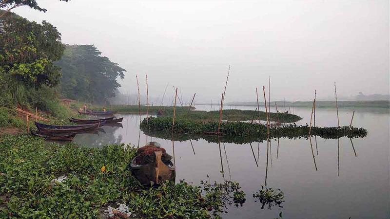
A misty morning on an oxbow lake in the Ayeyawady River delta © Liviu Giosan, Woods Hole Oceanographic Institution
The Ayeyawady River delta in Myanmar is home to millions of people, and is a hub of agricultural activity. Unlike other large rivers across the world, however, the Ayeyawady has been relatively untouched by large infrastructure and dam projects for the past 50 years, and its geologic evolution has never previously been studied.
A team from the Woods Hole Oceanographic Institution (WHOI) has collaborated with Myanmar scientists to present the first extensive view of the delta's history, revealing how its floodplains and shorelines on the Andaman Sea have grown and shrunk over the past 10,000 years. The study, published June 12, 2018, in the journal Earth Surface Dynamics, shows that shifts in monsoon climate have changed the shape of delta in the past, and suggests that human impact could drastically alter the region in the future, says lead author Liviu Giosan, a geologist at WHOI.
"In geological terms, the Ayeyawady, as any delta, is kind of an ephemeral feature. If the river can dump enough sediment onto the area through seasonal floods, the surrounding land will stay above sea level. But if those sediments can't keep up with sea level rise, the delta will eventually be submerged and overtaken by the sea" Giosan says.
According to the new study, the delta has changed repeatedly over the past several thousand years, showing that the region is particularly vulnerable to changes in outflow, ocean currents, or storm frequency.
To map the delta's geologic history, Giosan's team consulted 19th century British charts—which even today are the only available depth soundings off the Ayeyawady—to analyze long-submerged landscapes. They also turned to satellite imagery and NASA's digital elevation data to spot past channels but also shorelines, which appear as slight ridges in the otherwise flat landscape.
On the ground, the researchers dug trenches and drilled cores into those former shorelines and channels, revealing layers of sand and silt that they could then date in the lab. The resulting data showed that the ebb and flow of the delta was linked to extreme climate events: during long periods of heavy monsoons, more sediment traveled downriver, maintaining the delta's coastline. In dryer intervals, that flow dwindled, and waves and tides from the Andaman Sea chipped away at the landscape.
Most surprisingly, Giosan notes, plate tectonics has played a major role in the delta's shape. Instead of the uniform fan shape of most deltas, the modern shoreline of the Ayeyawady advanced far more quickly to the western side of the river than to the east, thanks to a major system of fault lines that run through the area.
"Myanmar sits directly where the Indian plate slides underneath the Asian plate. The fault system extends into the Andaman Sea, maintaining deeper waters and stronger tidal currents on the eastern side of river mouth that move sediments offshore. In the past the western side grew faster than the eastern coast, but this situation is about to change as dams are being built upriver," Giosan notes.
The team's study will provide a baseline for future scientific work in the region, as well as data that will help inform human development in the future. Its findings suggest that major dam projects in the future could alter the outflow of the Ayeyawady, reducing the sediments deposited downstream. That scenario could upset an already delicate balance, rendering homes and farmland on the delta potentially uninhabitable as the land erodes and seawater encroaches.
"Those effects can't be understood without showing how the delta evolved, how it formed, what direction it went at certain times, or why it switched from one region to another. You need that basis to address specific questions," Giosan adds.
Although he's passionate on a professional level about the work he's doing in Myanmar, Giosan is also quick to note that it appeals to him personally. Like Myanmar, his homeland of Romania was ruled for decades by a closed regime under Dictator Nicolae CeauÈescu.
"I know what it's like to live in a closed country," he says. "It's important to me that my colleagues in Myanmar get all the help they can, whether it's in education, or scientific areas."
Professor Thet Naing of Pathein University led the work in Myanmar together with Myo Min Tun of the University of Mandalay and Swe Thwin of Mawlamyine University. Other national and international partners included Peter D. Clift of Louisiana State University, Florin Filip of the Institute for Fluvial and Marine Studies in Bucharest, Romania, Stefan Constantinescu of Bucharest University, Nitesh Khonde of WHOI and Birbal Sahni Institute of Paleosciences in India, Jerzy Blusztajn of WHOI, Jan-Pieter Buylaert of the Technical University of Denmark, and Thomas Stevens of Uppsala University in Sweden.
For more information, please visit www.whoi.edu.
This article has been provided by the courtesy of Woods Hole Oceanographic Institution.