
Mbtiles for OpenCPN: A huge step forward for satellite charting
by Rob Murray 16 Jan 2020 11:57 UTC
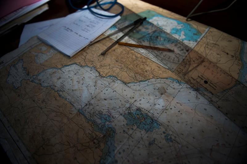
150131-F-QZ836-017 DJIBOUTI (January 31,2015) The charting maps for the Gulf of Tadjoura showing the exercise area of operations are displayed during Exercise Cutlass Express 2015 in Djibouti, Jan. 31, 2015 © U.S. Air Force photo by Staff Sgt. Carlin Leslie
OpenCPN has become a staple for cruisers. Even those that don't use it as their primary software for navigation have it loaded on a computer for use in planning, research and exchanging information with other cruisers. An increasingly capable navigation software suite, it is worth exploring and loading on your computer aboard.
Around 2005, mariners who were also computer geeks, began to realize the potential to use satellite imagery alongside nautical charts in poorly charted areas of the world, using (free) services like Google Earth™.
Around 2010, a sailor (Paul Higgins aboard Gday II) who was a programmer, developed GE2KAP (Google Earth to KAP (*.KAP files are a common file format for nautical charts)). This was a revelation: suddenly, you could see if charts were offset, see many uncharted hazards, and note details not contained on even the most detailed of nautical charts. Paul updates his work constantly, and has added *.Mbtile support in his new software SAT2CHART (SATellite to CHART).
Cruisers around the world began feverishly creating and sharing GE2KAP based 'chartlets' of under-charted regions and the safety of coast wise navigation soared. GE2KAP, while fantastic, had a few issues: it was a form of image capture, so you needed to do the coast, an area or anchorage at a time as you viewed it; it was time consuming, the form of image capture degraded the original satellite image through the process of converting it to a *.KAP file, and it was not possible to capture a high quality detailed image of a large area.
The new *.Mbtiles image format supported in OpenCPN version 5.0, released in May 2019, overcomes many of these issues, and makes creating detailed satellite images of large areas simple (although still time consuming). This article is designed as a walk through of one of the processes to create and use satellite images in OpenCPN using SasPlanet (a free Russian Geographic Information System software package), while getting you set up for other methods as you want to explore further.
Downloading and installing the software
First, gather snacks and beverages. Perhaps make a pot of coffee. We're going to be here a while. Take your Windows based PC, snacks and beverages to a place with good high speed internet - if at home, use an Ethernet cable directly to your PC if you can, it's faster than WiFi. Then download and install the following software:
- OpenCPN, version 5.0+
- SasPlanet, any version should be ok, but I chose to install it from the *.ZIP file on Paul Higgins' site to ensure compatibility with his work in SAT2CHART. Click on the link Sasplanet.zip. Unzip the SasPlanet directory in the zip file to your hard drive, for example to C:\SasPlanet. There is no 'install program' for SasPlanet: you click on the sasplanet.exe program file to run it. You can create a shortcut to make running it easier, by right clicking on the sasplanet.exe file and selecting 'create shortcut' and copying or dragging and dropping the shortcut to your desktop.
- Google Earth™. You MUST use an older version, as the newer versions are not compatible with SAT2CHART. If you have a version other than 7.1.2.2041 (circa 2013) on your PC, uninstall it via 'settings' or 'control panel' on your computer and then install the correct version from Paul Higgins' download site.
- SAT2CHART, available from Paul Higgins' download site (or a newer version if available). Run SAT2CHART, and it may ask you to install additional software; just follow the instructions.
All these were current links as of early October 2019, but are likely to change over time.
Configuring SasPlanet
Now open SasPlanet and configure it (open it by clicking on the sasplanet.exe file or the shortcut you created).
Step 1: Click 'view', and select 'main', 'zoom' and 'sources'.
Step 2: Click 'source' and choose 'Internet & Cache'
Step 3: Click 'settings', 'layer settings', and select 'Hybrid (Google)'
Step 4: Use 'file manager' program to find the file "C:\SasPlanet\Maps\sas.maps\Google\Ghyb.zmp" on your hard drive, and edit where it says "ru" to "en" (resetting the language from Russian to English)
Step 5: Go to 'settings', 'later settings' 'Hybrid (Google)', click and select 'settings Internet' edit the text in the popup box from "ru" to "en" (this resets the language from Russian to English).
Shut down SasPlanet and restart it for the reset language changes to take effect.
Creating your satellite charts
Now you're ready to get to work on creating satellite charts. Whew! There are two ways to do this with reasonable expedience. I will use the Gulf of Fonseca (approximately 13 degrees 13' North, 87 degrees 38' West) as an example.
First Method
In the first method, you download tiles in a batch, and then convert them to *.Mbtile. To download an area in a batch, select it with the rectangle or other area selection tool on the menu. View the satellite image at zoom level 10 or 11 (in zoom slider on right) so you don't select too large an area. Tile set of ~100,000 tiles seems to make manageable downloads and reasonable *.Mbtile 'charts' in use.
After you select the area, a box pops up. Select the zoom levels you want to download by ticking the 'zooms' boxes on the right for 16 and 18, select the 'download' tab, tick the 'close download window once finish' and set the 'split selection to, parts' to the maximum value (this will change based on area selected and computer used). Click 'start'. Take a breath, this will be a while.
After you have downloaded these images, they are available for viewing in SasPlanet, even when you are no longer connected to the Internet, as well as for re-processing and exporting as *.Mbtile, whether you're connected to the Internet or not. SasPlanet can be connected to a GPS and used as a satellite image chart viewer in its own right, but lacks the navigation features of OpenCPN.
Google does have some limits on downloads, and the Internet can sometimes fail in attempts to download image sets. If your finished product has gaps in coverage, review the downloaded area on the screen and re-download as required to 'fill in the blanks'. Enabling 'view' 'cached tiles map' and selecting the appropriate zoom level in SasPlanet will show via a shaded area what tiles you have downloaded for the specified zooms.
Notes on zoom levels:
I like 16 and 18; try them and see if that works for you. Not all areas of the earth have all levels of zoom. In some areas you may have to use lower zooms, like 14 and 16 or 15 and 17. While zoom levels above 18 are available for some areas, they don't seem to add much value for navigation (at least to my eye), and image sets below 12 or 14 don't seem to have much use value in navigation, as the detail is poor. When selecting zoom levels to download, I find skipping a level works fine and makes the Mbtiles chart smaller.
After the download completes and all the download windows close, go to the area selection tool again and select 'last selection'.
Export step: When you click this, the same box pops up as did for the download, but now select the 'export' tab, set the 'export selection to format' to 'Mbtiles 1.2 (SQLite3)', and enter the appropriate values in the 'save to' box (in this case the directory I want to save to: 'C:\charts\mbtiles\' and the filename, 'gulf of fonseca.mbtiles'). Using the *.Mbtiles file extension tells OpenCPN it's an Mbtiles file so it is appropriately indexed.
After a few minutes, this is complete, and you can add the directory in OpenCPN and view the charts. Click 'ok' or 'apply' or if incrementing an existing set of files with a new Mbtiles chart, click 'scan charts and update database' so OpenCPN indexes the files.
The area you have charted will show as a red outline:
When you zoom in you will see the detailed satellite images. Use the charts groups tool in OpenCPN to manage this with your other charts.
Second Method
In the second method for satellite image chart creation, you simply 'look around' in SasPlanet at the area of interest. As you look, zooming in and out, panning to maneuver around the area, SasPlanet caches (saves) what you look at. You will notice 'blank spots' in the view, filling in as you look around as it downloads the image tiles. After you are satisfied you have seen enough, you can then create a set of Mbtiles by following the direction from the 'export step' above. In this case, a wider range of zoom levels may be appropriate, and you will typically create a smaller file due to the lower level of detail.
Before "charting the world" by downloading lots and lots of images and creating millions of tiles, test the first file or two you create at different zoom levels on the PC and display you plan to use, as the resolution of the files will give a different view on different screens.
Creating large areas is rather tedious, so teaming up with another cruiser or two and tag-teaming an area makes sense, exchanging files later.
There are multiple data sources available for downloading via SasPlanet: Google, Bing, Yahoo, several Marine chart options (including Navionics), and you can review them and play around to see what works best for you. Not all of them work, and many have download limiting software on the database that limits the number of images you can get. I have found the Google to be the most detailed and 'freshest', but different areas could yield different results. I prefer the Hybrid view, which adds place names and objects of interest yet doesn't seem to impede the view of the coastline and water. Your opinion could be different, and you might like a different data source, or Google Maps non-Hybrid view without the place names.
Now that you're an expert on one aspect of satellite charting, you can use Paul's excellent SAT2CHART for other areas, or with specific aspects of the Google Earth application, to create other charts. Perhaps I will pen another article on how to get the most out of SAT2CHART, as a second in this series.
Have fun!
This article has been provided by the courtesy of Bluewater Cruising Association.