
How to sail to Mexico from the Pacific Northwest
by Rob Murray 29 Feb 2020 11:55 UTC
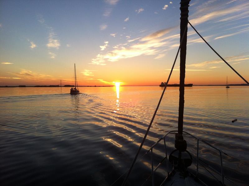
Avant © Rob Murray
Every year, dozens of boats depart from the Pacific Northwest aiming to reach the warmer climes of Mexico. For many cruisers, this is their 'maiden voyage', their first offshore passage. For many of the vessels, this is also a first offshore passage, or at least a first passage for new or upgraded systems aboard. Thus, for both boats and crews it is a rite of passage, a testing of mettle and a first test of new or upgraded systems.
We transited the coast southbound on Avant in August and September of 2013, and have met dozens of cruisers who made the same trip both before and after we did. I am basing this article and its embedded advice on our collective experience as I understand it.
The passage is not a spectacularly difficult one, and barely warrants a mention in Jimmy Cornell's "World Cruising Routes', where he states
"Winds along this route are always favourable, although they are sometimes too strong for comfort. Because of the big swell further offshore, it is advisable to stay as near the shore as caution permits. Several harbours have bars and are difficult or dangerous to enter when there is a heavy swell, especially if this breaks over the bar as it does in the entrance to the Columbia River. Another hazard along this coast is haze, which often reduces visibility drastically and can be extremely dangerous to small boats because of the high amount of shipping." (World Cruising Routes, Jimmy Cornell, 1987, page 176/177).
While sage advice, much is omitted in this statement, by nature of its brevity. Herewith, let me offer a perhaps more complete guide to transiting the coast safely and in relative comfort.
Deciding to go
Go to Port Angeles to check into the USA and obtain your 'Cruising License'. From Port Angeles, head to Neah Bay, about 50 nautical miles. (Pro tip: Neah Bay is a 'dry' community. Provision appropriately in Port Angeles.) Due to the predominantly west winds in the Strait of Juan de Fuca, you're likely to motor.
Obtaining your cruising license
For Canadian and other non-American cruisers, the journey typically begins in Port Angeles, where they check in to American Customs and obtain their American cruising license. The cruising license is important, as it is your proof of having entered the USA legally, and is valid for one year, and non-renewable. (Note, if you are not travelling on a Canadian or USA passport, you will also need an unexpired multiple entry Form I-94W, Non-immigrant Visa Waiver Arrival/Departure Form, or an unexpired passport, valid unexpired United States non-immigrant visa and I-94 Arrival/Departure Form. While most passports allow you to cross the border by automobile unhindered, and you can be issued a visa on the spot when arriving by road, the rules for boats are different and you must have the visa in hand before arrival. (We know cruisers who have been fined $500.00 for not having the visa in hand on arrival). Cruisers we know who checked into the USA in Friday Harbor or Point Roberts have told us of those offices not correctly understanding the cruising license and not issuing one, which can cause problems further south. The Port Angeles office seems to know what they're doing.
Ask for instructions on how to report as you travel south, as these may change from year to year. You should get a list of phone numbers for the successive Customs and Border Patrol areas you will use to report in. Generally, you must report on arrival when you arrive at each port; departure reporting is not required.
Making the left turn
It's from Neah Bay that you will execute your passage plan to get to San Francisco. Essentially, you will pass Cape Flattery (about 5 miles west), turn left, and sail south. However, therein lies the rub: how will you make the passage; where will you stop (or will you stop?), and how will you choose when and where to stay and when and where to go? As soon as you leave the Strait, the North Pacific is your mistress and you are at her mercy. As The Clash said in their 1982 hit 'Should I Stay or Should I Go':
Should I stay or should I go?
It's always tease, tease, tease
You're happy when I'm on my knees
One day it's fine and next it's black
So if you want me off your back
Well, come on and let me know
Should I stay or should I go?
Should I stay or should I go now?
If I go, there will be trouble
And if I stay it will be double
So come on and let me know
With the fickle North Pacific as your mistress, choosing wisely is critical. You don't want trouble. You certainly don't want double trouble. So when should you go, and when you do, how should you go?
When to go
First, the 'when'. Anytime after the spring blows are over (late April most years), and into the fall (before the winter gales arrive) is fine. Most cruisers leave in August or early September, because they do last minute refits over the summer, and also don't want to spend too long in Southern California where moorage can be difficult to find and is certainly expensive. Knowing they won't leave for Mexico before the end of hurricane season (roughly Halloween), they try to time arrival so they won't face extra months of high priced moorage in San Francisco or San Diego.
Planning to be gone from the Pacific Northwest in early August (and certainly before the end of August) is generally the best idea, and most likely to deliver the best weather. We left on the 18th of August, and still met a number of storms, including three back-to-back weather systems that pinned us in Astoria for three weeks.
The Coast Pilot 7 describes the arrival of winter rather poetically:
"Winter, like an incoming tide, creeps over the northeastern North Pacific. Subtle changes begin in September... Summer breezes become gales. Rain is commonplace. Winds and cool temperatures make the air feel damp and chilly. Storms become routine and onshore flow is near-persistent. Choppy seas turn rough."
Leaving later (after Labour Day) demands more caution, attention, and perhaps grit, as the windows of good weather are fewer and shorter, and the windows of poor weather are more frequent, longer and more intense. The likelihood of gales or storms is significantly higher. Bar crossings are likely to be more difficult, and generally the 'fun meter' may not register very high some days. The seasonal Coast Guard stations close, leaving only the year-round ones open, with reduced staff.
How to go
Then there is 'how'. There are, broadly speaking, three widely recommended passage plans to get south:
- The 'big jump': head out southwest until you are 60~80~100 miles offshore, turn to a near due south heading and maintain that until about 100 miles north of San Francisco, and then turn to a southeast heading until arrival. For sailing vessels, this is usually a trip that must be accomplished primarily under sail, as the 700 to 800 miles it entails exceeds the motoring range of most sailboats
- The 'two-step: head out to perhaps 15~25 miles offshore and proceed south, diverting to Crescent City or Eureka (some 400-500 miles from Neah Bay) for a rest and refueling stop. Ensure you have a good weather window to get around Cape Mendocino (~80mi from Crescent City, ~20mi from Eureka) and take the next leg to San Francisco (325-375 miles) when the weather permits.
- The 'lindy-hop': head out somewhat less than 25 miles offshore, and stop as desired (or indicated by the weather) at the myriad of ports along the coast. Make day or single overnight passages using weather windows as they present themselves, and arrive in San Francisco ASAC (As Soon As Comfortable). Wait out any weather that looks unpleasant or uncomfortable in ports along the way, and proceed at your own pace south.
Each has its charms and quirks, and each may suit a captain as their vessel's and crew's capabilities dictate.
The Big Jump
The big jump is appropriate if you're supremely confident in your vessel and have adequate crew for adverse conditions (think fully crewed race boat). It is the riskiest strategy, as you are embarking on a voyage of some 5-7 days, well past the capability of any forecaster to reasonably predict the weather, so you're rolling the dice on encountering gales, high seas, or worse. This route offers the best chance to earn a story of high winds and waves at sea, surviving a gale, breaking stuff, and so on.
This is the traditional route, and became tradition for several reasons:
- it involves the fewest landfalls (which were uncertain and difficult in pre-GPS days);
- it avoids much of the commercial and fishing traffic on the coast (which was difficult to manage in pre-AIS and pre-radar days);
- you can't lose crew en route (as there is nowhere for them to get off);
- it is the fastest end to end passage as no time is spent in port (important if you have crew with limited availability).
On the downside, most vessels taking this route encounter at least some adverse weather. It's a rare week that passes without a gale off the Pacific coast somewhere. The waves are typically higher further out, as Cornell suggests. If your vessel and crew are untested in multi-day at-sea passages, this may not be the shakedown cruise you want, and any gear or system failure that far offshore may be difficult or impossible to remedy. While most sailors believe that their vessel can withstand conditions far worse than the crew can take, getting past the point of crew comfort, let alone endurance, is no fun and most would seek to avoid finding these boundaries. If the offshore conditions are typical, they are similar to challenging or exhilarating conditions in the Strait of Georgia - and while 'sporty' sails like these can be 'fun' when you have the prospect of relaxing at the dock, at home, in a shore side pub or yacht club after a few hours, they do become wearing after 24 or 36 hours. Remember, the conditions will be cold no matter what time of year, and cold saps your energy. In the darkest lens of analysis, the only vessels lost on this passage I can recall over many years are those that chose this route.
The Two-Step
The two-step is a good choice if you have crew time constraints, because virtually any vessel can make the two legs under power or motor sailing (perhaps augmenting fuel aboard with jerry jugs), making arrival times more certain. Because each of the legs is shorter, they can be completed in 72-96 hours, making weather forecasting more (but not completely) reliable. As you have not ventured too far offshore, any serious gear failure can be remedied by altering the plan and heading inshore for parts and repairs.
If the weather forecaster was wrong and you anticipate or encounter worse conditions en route, you're close enough to shore to seek shelter in one of the many ports en route. Because you are not stopping, it's fairly quick, not spending nights in marinas along the way. Since Crescent City is the only port south of Neah Bay en route to San Francisco that doesn't have a bar at the entrance, your entry there is certain (although the port of Humboldt Bay/Eureka is 60mi closer to Cape Mendocino and, in my opinion, the town is more charming. I would choose to head in there over Crescent City if conditions allow). As Crescent City and Eureka are just north of Cape Mendocino (notable as the point on the coast where strong winds happen with the greatest frequency and persistence), you have the greatest certainty in your weather forecast for rounding this point.
On the downside, you will spend as many nights (and hours) traveling in the dark on this route as on the 'big jump'. This is an issue as crab pots, deadheads, other debris, and fishing vessels may be encountered along the way, and can't be as easily avoided in the dark (and because you're closer to shore, they will be more numerous). You may want to find and take crew, as these are multi day passages and watch keeping and crew fatigue can be an issue. You won't be visiting any of the ports en route. While perhaps not as attractive as the ports of Southern California and Mexico, you have to ask yourself when you might get the chance to visit again. If you divert to another port en route, you could lose crew to shore side demands on their schedules, putting you in the position of needing to find new crew, or divert to the 'Lindy-hop' passage plan.
The Lindy-Hop
The third option is the Lindy-hop. This option involves coastal cruising, similar to what you may have experienced in the Strait of Georgia. While this route takes the longest, it can be the most fun as you have a range of ports to visit (including, but not limited to: Neah Bay, La Push, Gray's Harbor, Astoria, Garibaldi, Depot Bay, Newport, Winchester, Coos Bay, Chetco/Brookings, Port Orford (anchorage only), Crescent City (no bar to cross), Humboldt Bay/Eureka, Fort Bragg, Bodega Bay and Drakes Bay (anchorage only)) all offering varying bar crossing experiences, the promise of a night's sleep, and sightseeing opportunities.
Because you are making shorter hops you have more control over how many hours you travel in the dark, and some hops can be made entirely in daylight. As you're making shorter legs, you will almost always be inside a 24 or 36 hour weather forecast, so the chances of the forecast being at serious variance with conditions you encounter is very, very low. You will be well rested, as the legs are not long enough for serious crew fatigue to develop (very important if you're sailing short handed or as a couple). Any gear failures will only have to be endured for a few hours before you can make port and deal with them (roughly 1/3 of the boats we know who passed down the coast had serious gear failures - autopilots, rudders, steering linkages, wind vanes, broken booms, furlers, etc.). The North Pacific is not a forgiving place to learn.
On the downside, this takes the longest, as you're spending nights in marinas or at anchor rather than under way. If you leave the Pacific Northwest late in the season, the windows of good weather become fewer as the days pass and winter sets in. It's the most expensive (because you're spending time in marinas, eating out, sightseeing, etc.). You can get 'stuck' if a weather window doesn't open while you're in any given port (although getting stuck is probably more fun than getting pasted off the coast). It does not give you a multi-day passage to test watch systems, cooking under way, and so on (although you can easily do that further down the coast in what are pretty well guaranteed to be far better conditions). The costs in marinas in Washington, Oregon and Northern California are reasonable, usually less than half what you will pay in San Francisco and points south, which goes some way to offsetting the cost of extra marina nights.
On Avant, we aimed for the two step, and a change in the weather forecast shifting the predicted winds from 20 knot north-westerlies to 30 knot southerlies, which made Astoria look very attractive. We then diverted to the Lindy-hop, stopping in Astoria, Coos Bay, and Eureka. Other vessels we sailed in company with that year also stopped in Gray's Harbor, Newport, Fort Bragg and Drakes Bay without issue.
Even though we enjoyed good weather windows and smooth seas, the effect of this passage was evident. For example, we left with a new box of corn flakes in a locker below and didn't open it on the trip. When we did open it in Southern California, we found the flakes reduced to dust by the constant motion.
No matter which route you choose, Drakes Bay usually offers a secure anchorage some 25mi from the Golden Gate Bridge, and the majority of cruisers take advantage of this to grab a few hours of rest and adjust their timing for entering San Francisco Bay.
This article has been provided by the courtesy of Bluewater Cruising Association.